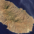
Dencukaay:Porto Praia, Santiago, Cape Verde.jpg

Dayoob bii wonendi: 600 × 600 pixel. Yeneen ñawaay: 240 × 240 pixel • 480 × 480 pixel • 768 × 768 pixel • 1 024 × 1 024 pixel • 2 048 × 2 048 pixel • 3 695 × 3 695 pixel.
réyal nataal bi ((3 695 × 3 695 pixels, réyaayu file bi : 4,53 Mio, type MIME : image/jpeg))
Jaar-jaaru dencukaay bi
Cuqal cib taariix/waxtu ngir gis ni dencukaay bi meloon ca jamono jooju.
| Taariix ak Waxtu | Tuutal | Dayoo | Jëfandikukat | Saraa | |
|---|---|---|---|---|---|
| teew | 14 Fewriyee 2011 à 11:52 |  | 3 695 × 3 695 (4,53 Mio) | Originalwana | {{Information |Description ={{en|1=Natural-colour image of Santiago. This image shows the rugged topography of Santiago.}} |Source =[http://earthobservatory.nasa.gov/IOTD/view.php?id=49219 NASA Earth Observatory] |Autho |
Xët yi am wii ŋara
Xët wii ci suuf ëmb na wii ŋara
Fépp fees jëfandikoo dencukaay bi
Yeneen wiki yiy toftal dañuy jëfandikoo itam bii dencukaay:
- Jëfandikoo nañu ko ci ca.wikipedia.org
- Jëfandikoo nañu ko ci en.wikipedia.org
- Jëfandikoo nañu ko ci fr.wikipedia.org

