Dencukaay:EU-Poland.svg

Taille de cet aperçu PNG pour ce fichier SVG : 713 × 600 pixel. Yeneen ñawaay: 285 × 240 pixel • 571 × 480 pixel • 913 × 768 pixel • 1 218 × 1 024 pixel • 2 435 × 2 048 pixel • 2 045 × 1 720 pixel.
réyal nataal bi (Dencukaay SVG, kem bu jaadu 2 045 × 1 720 pixel, dayoo dencukaay bi: 7,33 Mio)
польша
Faramfacce
Polski:
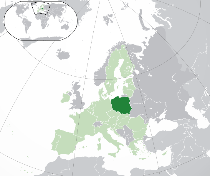
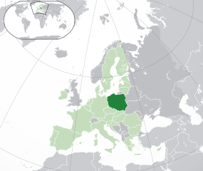
(Green) Polska.
(Light-green) Unia Europejska (UE).
(Gray) Europa.
(Light-gray) Inne terytoria.
| Faramfacce |
English: (Dark-Green) Poland. (Light-Green) The rest of the European Union (EU). (Dark-gray) The rest of Europe. (Light-gray) The surrounding region.
See also: |
| SVG information | Le code de ce grand fichier SVG n'est pas valide en raison de 12 erreurs. |
| Taariix | |
| Gongikuwaay | Travail personnel basé sur : Location European nation states.svg |
| Aji-jëf | NuclearVacuum |
| Autres versions |
|
| SVG information | Le code de ce grand fichier SVG n'est pas valide en raison de 12 erreurs. |


Anami Jëfandikoo gi
Moi, en tant que détenteur des droits d’auteur sur cette œuvre, je la publie sous les licences suivantes :
Jàppandeeb bii dencukaay a ngi aju ci sañal gu Creative Commons Féetale-Séddoo ci gennug anam 3.0 Unported
- Féeg nga ci:
- séddoo – duppi, séddale ak yónnee bile liggéey.
- soppi – soppi liggéey bi
- Ci kaw yii anam:
- Moomale – Fàww nga joxe ay xibaar yu leer ñeel boroom, joxe ab lëkkalekaay buy jëme ci sañal gi te wax ndax def nga ciy coppite. Man nga koo def ci anam yu bari, ba mu des ci guy wund ne aji-moom ji dafa ànd ak yaw walla ànd na ci ninga koy jëfandikoo)
- Séeddoo ci gii anamam – Soo soppee walla nga defar leneen te sukkadiku ci bii liggéey, faww nga siiwal ko ci genn sañal gi walla geneen gum méngool

|
Sañalees na duppi, séddale ak/walla soppi bile liggéey ci anami GNU Free Documentation License, Sumb 1.2 walla bépp sumb buFree Software Foundation mujjee siiwal; bu amul benn pàcc bees manul soppi, te amul it menn mbind ci xët wu njëkk week wu mujj wi. Ab sotti bu sañal gi jàppandi na ci pàcc bees duppee GNU Free Documentation License. |
Man ngaa tànn sañale gi la gënal.
Jaar-jaaru dencukaay bi
Cuqal cib taariix/waxtu ngir gis ni dencukaay bi meloon ca jamono jooju.
| Taariix ak Waxtu | Tuutal | Dayoo | Jëfandikukat | Saraa | |
|---|---|---|---|---|---|
| teew | 1 Fewriyee 2020 à 05:19 | | 2 045 × 1 720 (7,33 Mio) | Rob984 | UK and Gibraltar have left the EU. New base which includes all of Portugal's islands within frame, as well as Arctic Russian islands part of Europe. Also fixed Flevoland in the Netherlands. |
| 25 Oktoobar 2016 à 20:34 |  | 2 045 × 1 720 (7,32 Mio) | Giorgi Balakhadze | fix | |
| 24 Disembar 2015 à 09:25 |  | 2 045 × 1 720 (7,33 Mio) | Nordwestern | Per original framework and Commons' rules. Agree with A2D2. | |
| 18 Maars 2015 à 15:58 |  | 2 045 × 1 720 (7,38 Mio) | Mapclean | Reverted to Leftcry's version, please go to your talk page | |
| 21 Fewriyee 2015 à 14:10 |  | 2 045 × 1 720 (2,61 Mio) | VS6507 | Spain. Greece. Slovakia. Cyprus. Romania VETO | |
| 16 Nowembar 2014 à 19:34 |  | 2 045 × 1 720 (7,38 Mio) | Leftcry | Reverted to version as of 15:48, 6 August 2014 Please go to your talk page | |
| 16 Nowembar 2014 à 16:36 |  | 2 045 × 1 720 (2,61 Mio) | A2D2 | The map must show the original de-jure status with no breakaway regions, as it was originally created. An alternative map showing the de-facto status with breakaway regions needs to be created instead. | |
| 6 Ut 2014 à 15:48 |  | 2 045 × 1 720 (7,38 Mio) | Rob984 | Improved version: More accurate coastline, borders, etc. Added Gradient and Longitude and latitude lines. Sudan border. | |
| 1 Sulet 2013 à 09:31 |  | 2 045 × 1 720 (2,61 Mio) | U5K0 | croatia | |
| 23 Oktoobar 2009 à 14:41 |  | 2 045 × 1 720 (2,59 Mio) | NuclearVacuum | consensus version |
Xët yi am wii ŋara
Xët wii ci suuf ëmb na wii ŋara
Fépp fees jëfandikoo dencukaay bi
Yeneen wiki yiy toftal dañuy jëfandikoo itam bii dencukaay:
- Jëfandikoo nañu ko ci ace.wikipedia.org
- Jëfandikoo nañu ko ci ady.wikipedia.org
- Jëfandikoo nañu ko ci af.wikipedia.org
- Jëfandikoo nañu ko ci ami.wikipedia.org
- Jëfandikoo nañu ko ci ar.wikipedia.org
- العلاقات البولندية السعودية
- مستخدم:ElWaliElAlaoui/ملعب 8
- معاملة المثليين في بولندا
- مستخدم:جار الله/قائمة صور مقالات العلاقات الثنائية
- العلاقات الأمريكية البولندية
- العلاقات الأنغولية البولندية
- العلاقات البولندية الكورية الجنوبية
- العلاقات الإريترية البولندية
- العلاقات البولندية السويسرية
- العلاقات البولندية الليختنشتانية
- العلاقات البولندية البوليفية
- العلاقات البولندية الموزمبيقية
- العلاقات الألبانية البولندية
- العلاقات البلجيكية البولندية
- العلاقات الإثيوبية البولندية
- العلاقات البولندية البيلاروسية
- العلاقات البولندية الطاجيكستانية
- العلاقات البولندية الروسية
- العلاقات الأرجنتينية البولندية
- العلاقات البولندية الغامبية
- العلاقات البولندية القبرصية
- العلاقات البولندية السيراليونية
- العلاقات البولندية النيبالية
- العلاقات البولندية الليبيرية
- العلاقات التشيكية البولندية
- العلاقات البولندية الميانمارية
- العلاقات البولندية الكندية
- العلاقات البولندية الزيمبابوية
- العلاقات الإسرائيلية البولندية
- العلاقات البالاوية البولندية
- العلاقات البولندية المالية
- العلاقات البولندية النيجيرية
- العلاقات اليمنية البولندية
- العلاقات البولندية الفانواتية
- العلاقات الغابونية البولندية
- العلاقات البنمية البولندية
- العلاقات البولندية الكوبية
- العلاقات البولندية الجورجية
- العلاقات البولندية التونسية
- العلاقات البولندية الكورية الشمالية
- العلاقات الهندية البولندية
- العلاقات اليابانية البولندية
- العلاقات الإيطالية البولندية
- العلاقات البولندية الناوروية
- العلاقات الأسترالية البولندية
- العلاقات البولندية الزامبية
Wone njëfandikoo gu daj gu bii dencukaay.