Dencukaay:Aerial photograph of Salford and Trafford Park.jpg

Dayoob bii wonendi: 800 × 600 pixel. Yeneen ñawaay: 320 × 240 pixel • 640 × 480 pixel • 1 024 × 768 pixel • 1 280 × 960 pixel • 2 048 × 1 536 pixel.
réyal nataal bi ((2 048 × 1 536 pixels, réyaayu file bi : 3,32 Mio, type MIME : image/jpeg))
| Faramfacce |
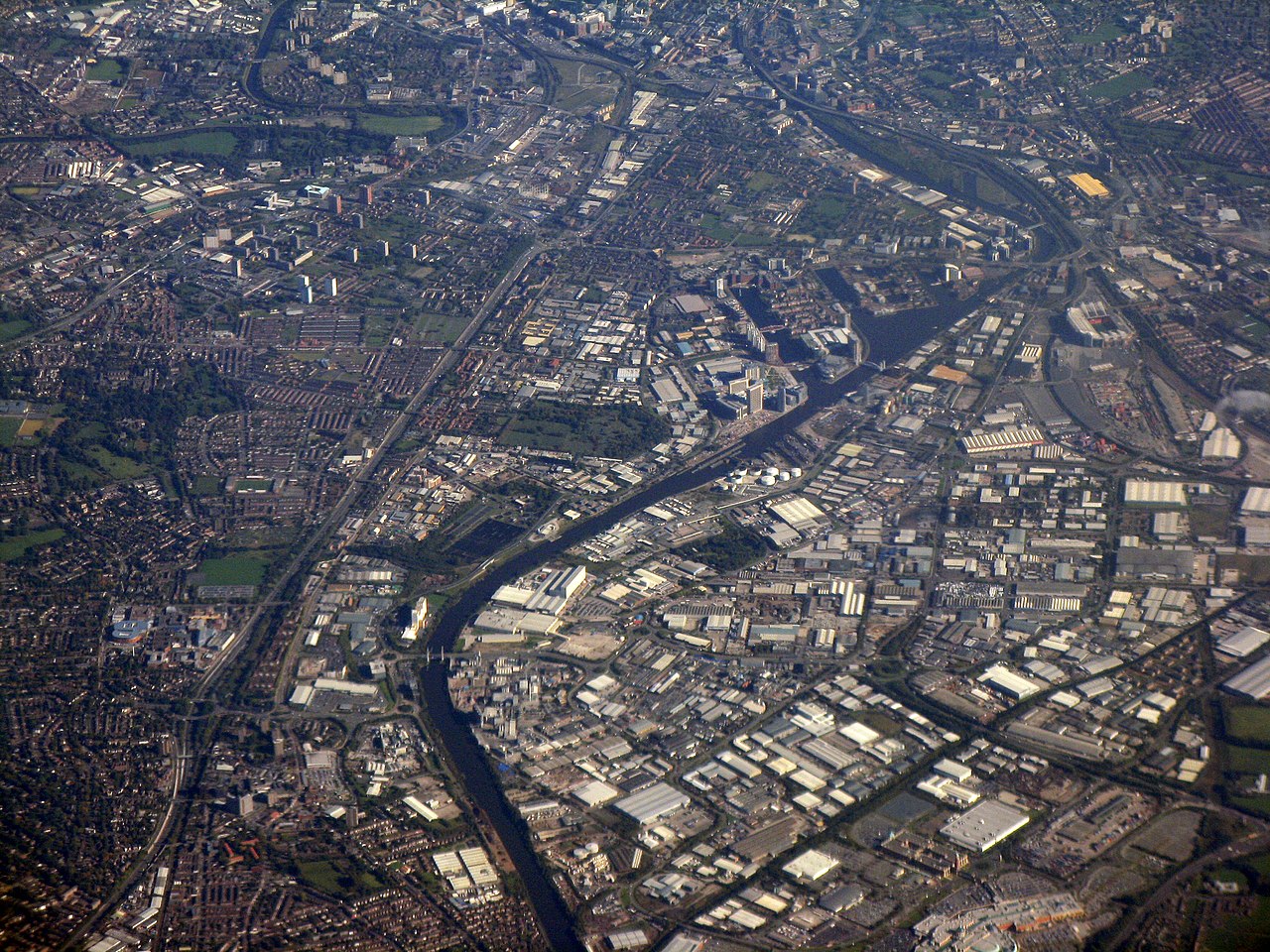
An aerial photograph of Salford (left half of image), Salford Quays (centre part of image), Trafford Park (bottom-right quartile of image), and the fringes of Manchester city centre (the top 10% of the image), all of which are in Greater Manchester, England. Landmarks in this shot include the meander of the River Irwell by Salford University (top left), and (beneath that) the tower blocks at Pendleton in Salford. The waters of the Manchester Ship Canal bisect the image, very roughly down the middle. On the right-hand side, about two-thirds the way up, is Old Trafford, the home stadium of Manchester United F.C. Trafford Park spans the bottom-right quartile of the image. |
||
| Taariix | |||
| Gongikuwaay | https://www.geograph.org.uk/photo/2103098 | ||
| Aji-jëf | M J Richardson | ||
| Sañal (Njëfandikoowaatu bii dencukaay) |
Ce fichier est disponible selon les termes de la licence Creative Commons Attribution – Partage dans les Mêmes Conditions 2.0 Générique Moomale: M J Richardson
|

| Lieu de la prise de vue | | Voir cet endroit et d’autres images sur : OpenStreetMap |
|---|
_heading:90.00&language=wo)
| Position de l'objet | | Voir cet endroit et d’autres images sur : OpenStreetMap |
|---|
_heading:90.00&language=wo)
Jaar-jaaru dencukaay bi
Cuqal cib taariix/waxtu ngir gis ni dencukaay bi meloon ca jamono jooju.
| Taariix ak Waxtu | Tuutal | Dayoo | Jëfandikukat | Saraa | |
|---|---|---|---|---|---|
| teew | 11 Oktoobar 2010 à 13:24 | | 2 048 × 1 536 (3,32 Mio) | Jza84 | Adjusted contrast and colour to sharpen image and remove mist |
| 11 Oktoobar 2010 à 13:20 |  | 2 048 × 1 536 (2,01 Mio) | Jza84 | {{Information |Description=An aerial photograph of Salford (left half of image), Salford Quays (centre part of image), Trafford Park (bottom-right quartile of image), and the fringes of Manchester city centre (the top 10% of the image), all of which are i |
Xët yi am wii ŋara
Xët wii ci suuf ëmb na wii ŋara
Fépp fees jëfandikoo dencukaay bi
Yeneen wiki yiy toftal dañuy jëfandikoo itam bii dencukaay:
- Jëfandikoo nañu ko ci en.wikipedia.org