Dencukaay:Khartoum 32.53706E 15.60754N.jpg
Dayoob bii wonendi: 800 × 599 pixel. Yeneen ñawaay: 320 × 240 pixel • 640 × 479 pixel • 1 024 × 766 pixel • 1 280 × 958 pixel.
réyal nataal bi ((1 280 × 958 pixels, réyaayu file bi : 205 kio, type MIME : image/jpeg))
Faramfacce
| Faramfacce |
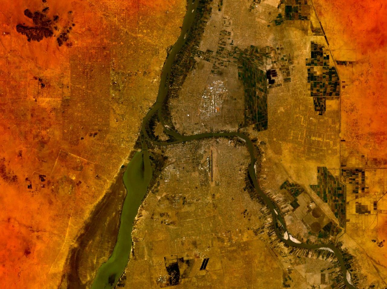
Deutsch: Die Städte Omdurman (links), Bahri (oben rechts) und Khartum (unten rechts) getrennt durch den Nil.
English: The cities Omdurman (left), Bahri (top right) and Khartoum (bottom right) divided through the Nile river. |
| Taariix | avant Mee 2005 |
| Gongikuwaay | NASA World Wind screenshot. |
| Aji-jëf | Photographie : NASA |
Anami Jëfandikoo gi
| Cette image est dans le domaine public car elle est constituée d'une capture d'écran du logiciel World Wind de la NASA qui utilise des données du domaine public, comme Blue Marble, MODIS, Landsat, SRTM, USGS ou GLOBE.
|
 |
Jaar-jaaru dencukaay bi
Cuqal cib taariix/waxtu ngir gis ni dencukaay bi meloon ca jamono jooju.
| Taariix ak Waxtu | Tuutal | Dayoo | Jëfandikukat | Saraa | |
|---|---|---|---|---|---|
| teew | 15 Mee 2005 à 10:49 | | 1 280 × 958 (205 kio) | Rex | NASA World Wind screenshot. {{PD-USGov-NASA}} Category:Maps of Sudan |
Xët yi am wii ŋara
Xët wii ci suuf ëmb na wii ŋara
Fépp fees jëfandikoo dencukaay bi
Yeneen wiki yiy toftal dañuy jëfandikoo itam bii dencukaay:
- Jëfandikoo nañu ko ci ast.wikipedia.org
- Jëfandikoo nañu ko ci azb.wikipedia.org
- Jëfandikoo nañu ko ci ca.wikipedia.org
- Jëfandikoo nañu ko ci cs.wikipedia.org
- Jëfandikoo nañu ko ci de.wikipedia.org
- Jëfandikoo nañu ko ci el.wikipedia.org
- Jëfandikoo nañu ko ci en.wikipedia.org
- Jëfandikoo nañu ko ci es.wikipedia.org
- Jëfandikoo nañu ko ci hu.wikipedia.org
- Jëfandikoo nañu ko ci hy.wikipedia.org
- Jëfandikoo nañu ko ci ja.wikipedia.org
- Jëfandikoo nañu ko ci mt.wikipedia.org
- Jëfandikoo nañu ko ci nl.wikipedia.org
- Jëfandikoo nañu ko ci pl.wikipedia.org
- Jëfandikoo nañu ko ci pl.wiktionary.org
- Jëfandikoo nañu ko ci pt.wikipedia.org
- Jëfandikoo nañu ko ci ru.wikipedia.org
- Jëfandikoo nañu ko ci sk.wikipedia.org
- Jëfandikoo nañu ko ci sr.wikipedia.org
- Jëfandikoo nañu ko ci sw.wikipedia.org
- Jëfandikoo nañu ko ci uk.wikipedia.org